U.S. Road Signs: Route marker signs 2026
M1 series Route shields

A green business-loop marker for a three-digit route, guiding drivers off the interstate through a town's business district before rejoining the highway.

A green business-spur marker for a three-digit route, leading drivers from the interstate into a business area on a route that does not loop back.
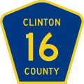
A county route marker identifying a locally maintained numbered road, helping drivers follow county highways away from state and federal routes.
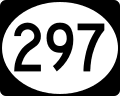
An oval-shaped state route marker showing a three-digit number, used by some states to identify their numbered state highways.
.svg.png&w=256&q=75)
An interstate shield naming the state and a three-digit number, marking an auxiliary interstate that branches from or connects to a main route.
.svg.png&w=256&q=75)
An interstate shield showing the state name and a two-digit number, identifying a primary interstate highway for drivers following the route.
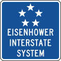
The Eisenhower Interstate System shield, a red, white, and blue marker honoring the interstate network's founder and identifying a numbered interstate route.

A variant of the Eisenhower Interstate System shield with the five-star emblem, marking an interstate route within the national network.
.svg.png&w=256&q=75)
The classic red, white, and blue interstate shield with a two-digit number, identifying a main interstate highway for through travelers.
.svg.png&w=256&q=75)
An interstate shield carrying a three-digit number, marking an auxiliary interstate such as a loop or spur that serves a metropolitan area.

A green business-loop marker for a two-digit route, routing drivers off the interstate through a town's business district and back to the highway.

A green business-spur marker for a two-digit route, guiding drivers from the interstate into a business district on a spur that does not return.
.svg.png&w=256&q=75)
The black-and-white U.S. highway shield with a two-digit number, identifying a federal route in the nationwide U.S. numbered highway system.
.svg.png&w=256&q=75)
The U.S. highway shield showing a three-digit number, marking a branch of the U.S. numbered highway system for drivers following the route.

A generic state route marker displaying a two-digit number inside a white circle, used where a state has no distinctive shield design.

A brown Forest Route marker identifying a numbered road within a national forest, helping drivers navigate federal forest lands.
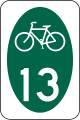
A green pentagon bicycle route marker identifying a numbered state or local bike route, guiding cyclists along a designated path.
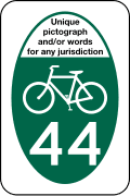
A variant state or local bicycle route marker with a route number, confirming to cyclists they are on the designated numbered bike route.
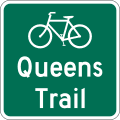
A non-numbered bicycle route marker with two lines of text, identifying a named bike route where no route number is assigned.
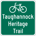
A non-numbered bicycle route marker with three lines of text, naming a designated bike route that does not carry a route number.
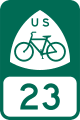
A U.S. Bicycle Route marker identifying part of the national numbered bicycle route network for cyclists traveling long distances.
M2 series Junction markers
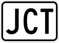
A JUNCTION plaque mounted above a route shield, telling drivers that an intersection with the numbered route it names is just ahead.
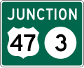
A combination junction assembly grouping two route shields, showing drivers that both numbered routes meet at the intersection ahead.
M3 series Cardinal direction markers
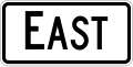
An EAST directional plaque paired with a route shield, telling drivers the eastbound direction of the numbered route they are following.
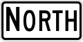
A NORTH directional plaque paired with a route shield, indicating the northbound direction of the numbered route for drivers making a turn.
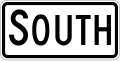
A SOUTH directional plaque paired with a route shield, indicating the southbound direction of the numbered route drivers wish to follow.

A WEST directional plaque paired with a route shield, telling drivers which way leads to the westbound direction of the numbered route.
M4 series Route marker auxiliaries
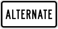
An ALTERNATE plaque placed with a route shield, marking an alternate version of the numbered route that parallels the main highway.
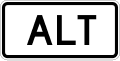
An abbreviated ALT plaque used with a route shield, identifying an alternate branch of the numbered route for drivers.

A BUSINESS plaque mounted with a route shield, marking a business route that carries the numbered highway through a town's commercial center.
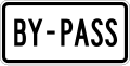
A BY-PASS plaque paired with a route shield, marking a bypass route that carries the numbered highway around a town instead of through it.

A toll-plaza cashier symbol directing drivers to a staffed lane where tolls can be paid to an attendant.

An END plaque mounted with a route shield, marking the point where the numbered route terminates and no longer continues.

A toll-plaza exact-change symbol directing drivers to a lane where the toll must be paid with the exact coins, without receiving change.

A detour marker with a left arrow, guiding drivers to turn left to follow the signed detour around a closed section of route.

A detour marker with a right arrow, guiding drivers to turn right to follow the signed detour around a closed section of route.
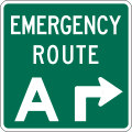
An Emergency Route marker identifying a designated evacuation or emergency corridor drivers should follow during hurricanes or other emergencies.
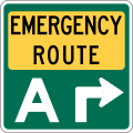
A variant Emergency Route marker designating a road set aside as an emergency or evacuation corridor for use during emergencies.
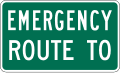
An emergency-route TO plaque mounted with a route shield, directing drivers toward the numbered highway that forms the emergency corridor.
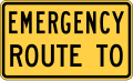
A variant emergency-route TO plaque used with a route shield, pointing drivers toward the numbered highway serving as the emergency route.
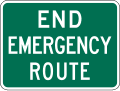
An END EMERGENCY ROUTE marker showing where the designated emergency or evacuation corridor terminates and normal routing resumes.
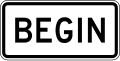
A BEGIN plaque mounted with a route shield, marking the starting point of the numbered route or a special designation such as a detour.
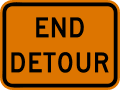
An END DETOUR marker telling drivers the detour is finished and they may rejoin the original route they were following.

An END plaque used where a work zone had closed the road, signaling drivers that the detour ends and the normal route resumes.

A DETOUR plaque mounted with a route shield, alerting drivers that the numbered route is temporarily rerouted along a marked detour.
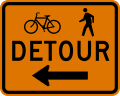
A bicycle and pedestrian detour marker with a left arrow, guiding cyclists and walkers to turn left onto the signed alternate path.
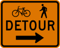
A bicycle and pedestrian detour marker with a right arrow, guiding cyclists and walkers to turn right onto the signed alternate path.
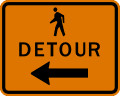
A pedestrian detour marker with a left arrow, directing people on foot to turn left to follow the temporary walking route.
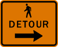
A pedestrian detour marker with a right arrow, directing people on foot to turn right to follow the temporary walking route.
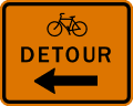
A bicycle detour marker directing riders to turn left, guiding cyclists around a closed or impassable segment of a designated bike route.
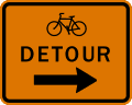
A bicycle detour marker pointing right, steering cyclists onto an alternate path when their normal bike route is blocked or under construction.
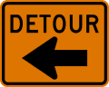
A detour auxiliary marker with a left arrow, used with route shields to route traffic left around a closed or restricted roadway.
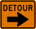
A detour auxiliary marker with a right arrow, guiding vehicles right onto a temporary alternate route when the usual road is closed.

A small auxiliary plaque reading Temporary, mounted with a route shield to show that the marked routing is a short-term detour rather than permanent.

An abbreviated Temp plaque paired with a route marker, signaling that the indicated path is a temporary alternate rather than the standard route.
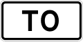
A To plaque placed above a route shield, telling drivers the road ahead connects to that highway rather than being the highway itself.
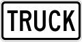
A Truck plaque used with a route marker to designate a truck route, directing large vehicles along the roadway approved for them.
M5 series Advance turn arrow auxiliary signs

An advance turn arrow bending left at a right angle, mounted below a route shield to warn that the route turns sharply left ahead.

An advance turn arrow bending right at a right angle, posted under a route marker to alert drivers the route makes a sharp right turn ahead.

An advance turn arrow angling left at 45 degrees, shown with a route shield to prepare drivers for a gradual left turn to stay on the route.

An advance turn arrow angling right at 45 degrees, used with a route marker to signal a gradual right turn ahead to remain on the route.

An advance turn arrow for a roundabout showing a left exit, telling drivers the route leaves the circular intersection to the left.

An advance turn arrow for a roundabout showing a right exit, indicating the route departs the circular intersection to the right.
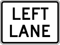
A lane-designation plaque reading Left Lane, mounted with route markers to tell drivers which lane to use for the upcoming turn or route.
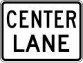
A lane-designation plaque reading Center Lane, guiding drivers to position in the middle lane to follow the route ahead.
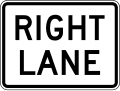
A lane-designation plaque reading Right Lane, directing drivers to use the right lane for the upcoming route or turn movement.
M6 series Directional arrow auxiliary signs

A directional arrow pointing left, mounted below a route shield at an intersection to confirm the route continues to the left.

A directional arrow pointing right, placed under a route marker to show that the numbered route turns right at the intersection.

A downward-slanting diagonal arrow pointing to the lower left, used with a route shield to point toward a ramp or road angling off to the left.

A downward-slanting diagonal arrow pointing to the lower right, guiding drivers toward a ramp or road that branches off to the right.

A diagonal arrow pointing up and to the left, mounted with a route marker to indicate the route veers off to the left ahead.

A diagonal arrow pointing up and to the right, shown with a route shield to indicate the route branches off to the right ahead.

A straight-ahead directional arrow paired with a route marker, confirming that the numbered route continues straight through the intersection.

A double directional arrow pointing both left and right, indicating the route splits so drivers can turn either direction to follow it.

A double diagonal arrow emphasizing a left direction, used with route shields where the route angles to the left at a junction.

A double diagonal arrow emphasizing a right direction, marking where the route angles off to the right at a junction.

A combined arrow showing left and straight, telling drivers the route can be followed by turning left or continuing straight ahead.

A combined arrow showing straight and right, indicating the route continues either straight ahead or by turning right.

A combined arrow showing a diagonal left and straight movement, guiding drivers who can bear left or go straight to stay on the route.

A combined arrow showing straight and a diagonal right movement, for drivers who can continue straight or bear right to follow the route.
M10 series Scenic area

The National Scenic Byway marker identifies a federally recognized scenic route, letting travelers know they are on a nationally designated byway.

A National Scenic Byway plaque mounted with a route shield, adding the byway designation to the marked road for travelers.
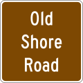
A byway identification marker naming a specific scenic byway so drivers can recognize and follow that particular designated route.
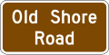
A byway identification plaque paired with a route shield, spelling out the name of the scenic byway the road belongs to.
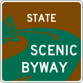
A state scenic byway system marker showing a road is part of a state-designated network of scenic routes.
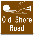
A state scenic byway marker combining a simple graphic with the byway name, identifying a specific route in the state scenic system.
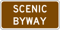
A scenic byway plaque mounted below a route marker, labeling the road as part of a designated scenic byway.
M11 series National Historic Trails
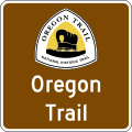
A National Historic Trail identification marker showing that the road follows or crosses a congressionally designated historic trail.
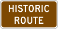
A Historic Route plaque used with a National Historic Trail marker, noting the road traces the path of a designated historic trail.
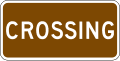
A Crossing plaque paired with a National Historic Trail marker, indicating the point where the roadway intersects a historic trail.
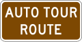
An Auto Tour Route plaque with a National Historic Trail marker, guiding motorists along a driving tour that follows the historic trail.
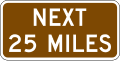
A distance plaque mounted with a National Historic Trail marker, showing the mileage to a point along the designated historic trail.

Have a question? Contact Us
Have questions about preparing for your DMV exam or need assistance with our tools? Reach out to us — we're here to help you succeed on your journey to getting your license

Send us a message
By sending this message, you agree to our terms and conditions.